|
|
|
|
Results from Experiment 0: TMIN Time Series
|
|
|
Time series of precipitation are computed as the grid point average of monthly
accumulation. The number of grid points within each region is determined by
the map projection and the land-sea mask. Grid points over water are not
included in the grid point average. The land-sea mask is generated for
each model by using the land-sea mask of the CRU dataset. For each model
grid point, the nearest CRU grid point is found and the surface type (land
or water) of the CRU grid point is assigned to the model grid point.
| |
Experiment 0.0 |
Experiment 0.1 |
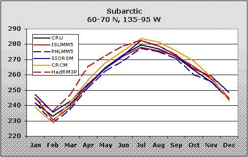
Subarctic
60-70N, 135-95W |
 |
 |
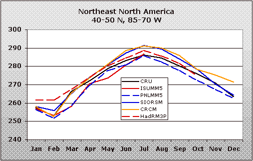
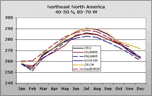
Northeast
40-50N, 85-70W |
 |
 |
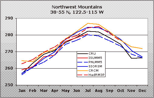
Northwest
38-55N, 122.5-115W |
 |
 |
Southwest
20-35N, 115-110W |
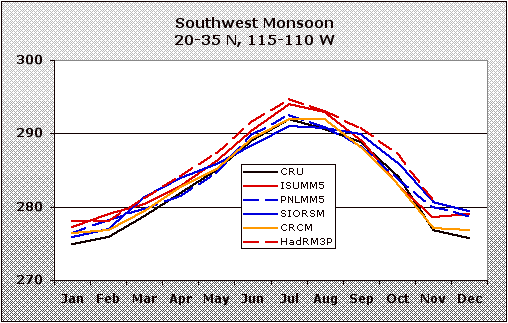 |
 |
North Plains
40-55N, 102.5-90W |
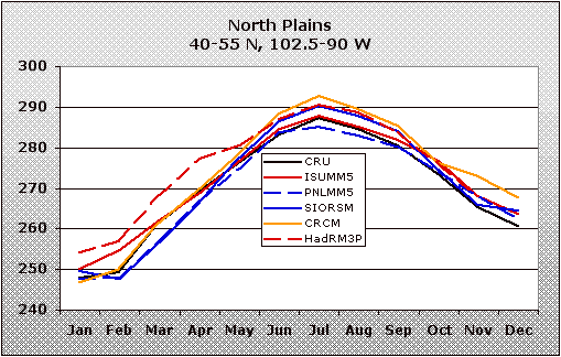 |
 |
South Plains
30-40N, 102.5-90W |
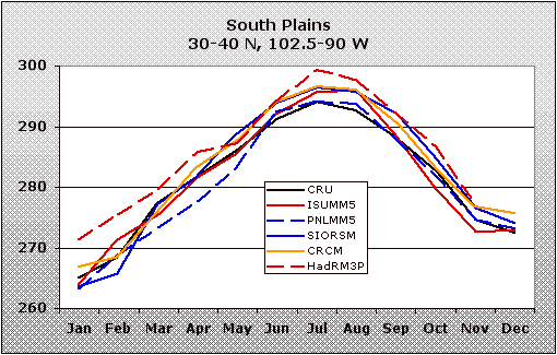 |
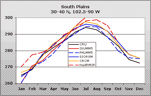 |
Southeast
32.5-40N, 90-80W |
 |
 |
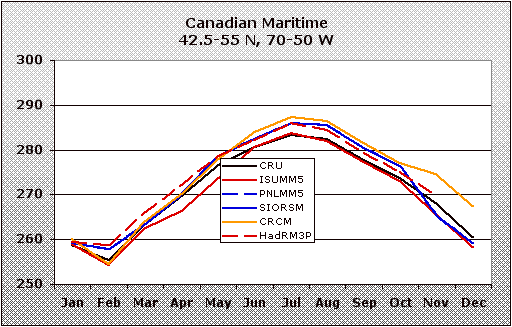
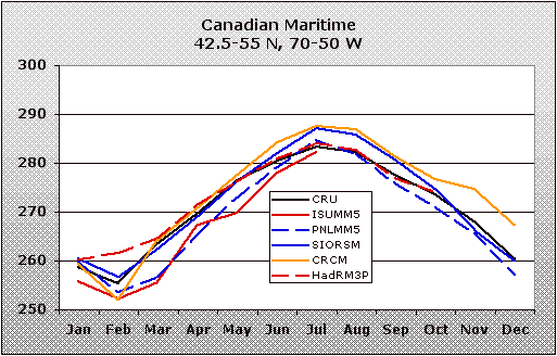
Canadian Maritime
42.5-55N, 70-50W |
 |
 |
Canadian Prairie
42.5-55N, 120-100W |
 |
 |
|
|